- North Narrabeen, NSW(edit)
- Gift cards
- Warranty
- Returns
- Find us
- Contact us
G'day there!
create an account
Details & Specs
Every adventurer knows that you can’t rely on a GPS when travelling, which is this map is essential when driving through North East New South Wales.
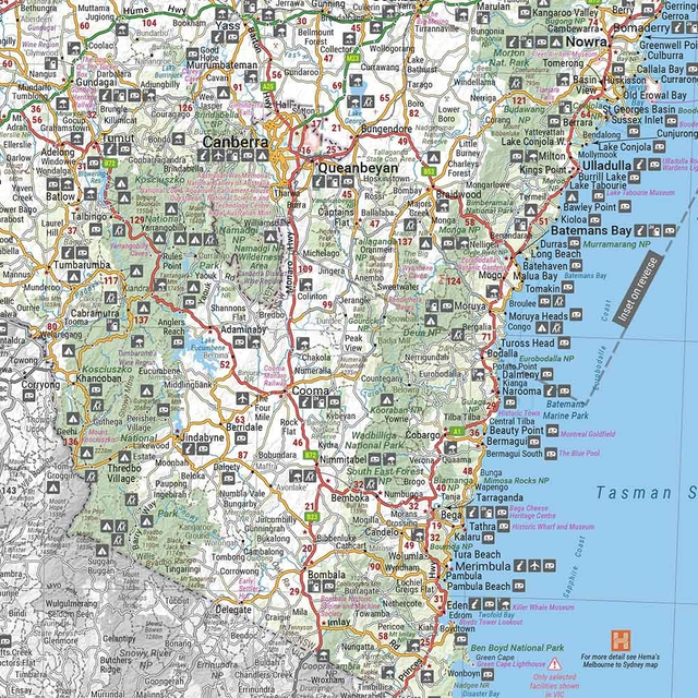
This regional map of North East New South Wales (1:375,000) from Hema will help guide you through this region including the Summerland Way, Bruxner Highway, Waterfall Way, and
It also contains helpful information about the national parks in the region, the places you can camp, wilderness spots, information for tourists, and other points of interest that might be of help.
- Routes included: Summerland Way, Bruxner Highway, Waterfall Way, and
Gwyndir Highway and tourist attractions along both the Pacific Highway and the New England Highway - Major tourist attractions on the Pacific Highway and New England Highway
- Camping areas, national parks, wilderness areas, tourist information and points of interest
Reviews
(1)
5.0
1
Q&A's
You might also like... (2)
Similar gear (4)
-
Call us: 1300 914 007
Mon - Fri: 8.30am - 5:00pm
Sat: 9am - 4pm
Sun: ClosedOur support team is based in Adelaide(SA time)Heads up! Our Customer Support Team will be offline for the Easter Weekend and on the ANZAC Day Public Holiday. - Email usservice@snowys.com.au
-
Find us
Find us
92 Richmond Rd, Keswick SA Mon - Fri: 9am - 5:30pm
Sat: 9am - 5pm
Sun: 10am - 5pm17 Doherty St, Brendale QLD Mon - Fri: 9am - 5pm
Sat: 9am - 5pm
Sun: 9:30am - 2:30pmHeads up! Our stores will be closed and customer support team offline over the Easter Weekend and on the ANZAC Day Public Holiday.


- Epic Easter Deals!
-
By Brand
-
Business Sales
- Gift Cards
- Spare Parts
- Blog
Whether you're buying bulk for yourself, or through work, submit a quote request below and we'll work with our suppliers to offer our best price.
- Schools
- Clubs
- Scout groups
- Government departments
- Businesses
- or, just ordering a bulk amount with mates

-
Heads up! Our stores will be closed and customer support team offline over the Easter Weekend and on the ANZAC Day Public Holiday.92 Richmond Rd, Keswick SA17 Doherty St, Brendale QLD


